UN
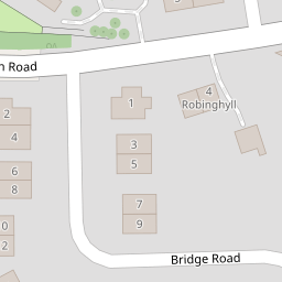
5 Main Road
£ 172,000
Description
We don't have a Description for this property.
- Bedrooms
- 3
- Bathrooms
- 0

Leaflet © OpenStreetMap contributors
The heatmap indicates the level of crime in the area. The color of the heatmap indicates the crime severity and recency.
Metrics Year-on-Year
- Average area value
- 407,139.00 £Decreased by 4.00 %
- Average area rental value
- 1,723.00 £/moIncreased by 16.11 %
- Est rental Yield
- 5.08 %Increased by 20.95 %
- Crime Rate
- 52.00 %Unchanged by 0.00 %
from 424,119.00 £
from 1,484.00 £/mo
from 4.20 %
from 52.00 %
Nearby Schools
| Name | Type | Ofsted | Distance |
|---|---|---|---|
| Nether Kellet Community Primary School | Community School | Outstanding | 0.18 KM |
| The Carnforth Hub | Children's Centre | 2.13 KM | |
| Carnforth High School | Academy Converter | 2.21 KM | |
| Our Lady Of Lourdes Catholic Primary School, Carnforth | Voluntary Aided School | Good | 2.33 KM |
| Carnforth Community Primary School | Community School | Good | 2.48 KM |
Images
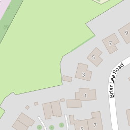
Nearby Streets
| Name | Average Price | Average Sqft | Distance |
|---|---|---|---|
| Springfield Gardens | £ 300,000 | 0 | 0.00 KM |
| Ashmeadow Grove | £ 325,000 | 0 | 0.00 KM |
| Ashmeadow Road | £ 300,000 | 0 | 0.00 KM |
| Hill Lane | £ 290,000 | 0 | 0.00 KM |
| Long Dales Lane | £ 0 | 0 | 0.00 KM |
Nearby Transport
| Name | NLC | TLC | Distance |
|---|---|---|---|
| Carnforth | 2640 | CNF | 2.81 KM |
| Lancaster | 2685 | LAN | 8.12 KM |
| Silverdale | 1968 | SVR | 8.47 KM |
| Bare Lane | 2690 | BAR | 8.83 KM |
Nearby Listings
| Address | Price | Type | Score | Distance |
|---|---|---|---|---|
| Bridge Road, Nether Kellet, Carnforth | £ 325,000 | BUY | Unknown | 0.10 KM |
| Bridge Road, Nether Kellet, Carnforth | £ 239,950 | BUY | Unknown | 0.10 KM |
| Shaw Lane, Carnforth, LA6 | £ 300,000 | BUY | 6 / 10 | 0.18 KM |
| Springfield Gardens, Nether Kellet, LA6 | £ 300,000 | BUY | 6 / 10 | 0.50 KM |
| Shaw Lane, Nether Kellet, Carnforth, LA6 | £ 280,000 | BUY | 7 / 10 | 0.56 KM |
Nearby Properties
| Address | Price | Distance |
|---|---|---|
| 5 Main Road | £ 172,000 | 0.00 KM |
| 2 Main Road | £ 180,000 | 0.00 KM |
| 1 Briarlea Road | £ 300,000 | 0.06 KM |
| 5 Briarlea Road | £ 205,000 | 0.06 KM |
| 8 Briarlea Road | £ 60,000 | 0.06 KM |